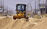
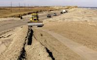
FILE - A bulldozer clears sand from N.C. highway 12, Sunday, Sept. 21, 2003, in Kill Devil Hills, N.C., after Hurricane Isabel hit North Carolina's Outer Banks. (AP Photo/Bob Jordan)
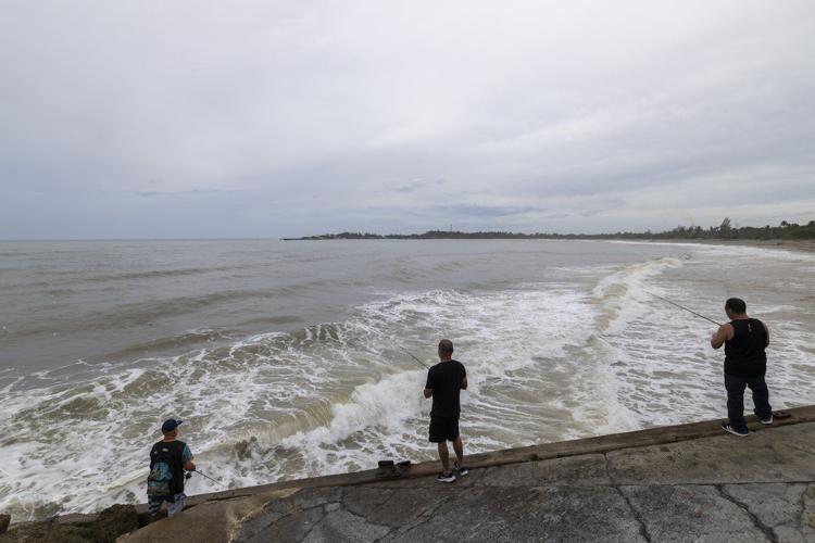
People fish along the shore in Arecibo, Puerto Rico, as Hurricane Erin brings rains to the island, Sunday, Aug. 17, 2025. (AP Photo/Alejandro Granadillo)
In this aerial image taken from video provided by WVEC-TV, homes along the Atlantic Coast in Dare County, N.C., are seen, Monday, Aug. 18, 2025, ahead of expected impacts from Hurricane Erin. (WVEC-TV via AP)
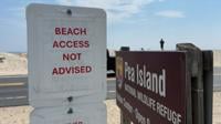
In this image taken from video provided by WVEC-TV, a sign warning against beach access is posted in Dare County, N.C., Monday, Aug. 18, 2025, ahead of expected impacts from Hurricane Erin. (WVEC-TV via AP)
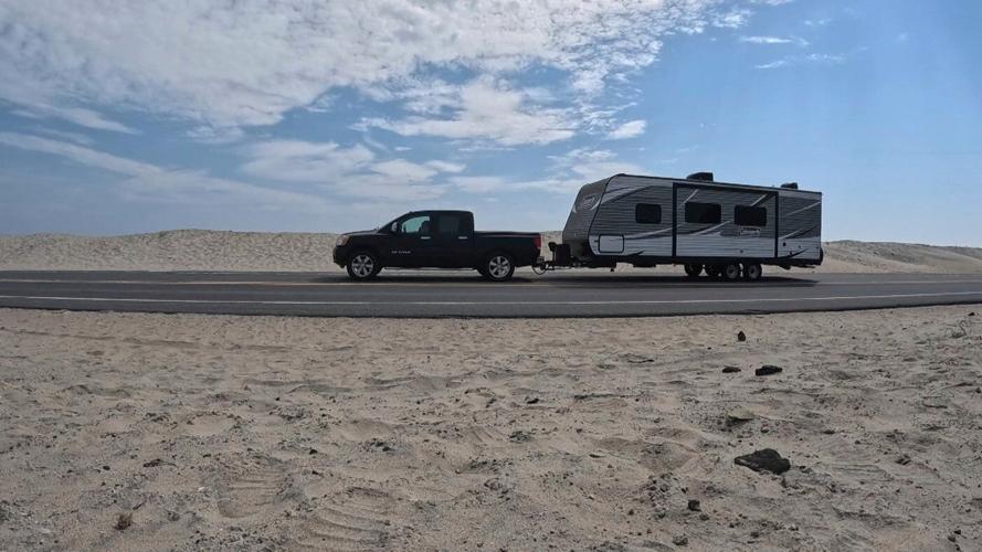
In this image taken from video provided by WVEC-TV, a vehicle with a trailer is traveling on Highway 12 in Dare County, N.C., Monday, Aug. 18, 2025, ahead of expected impacts from Hurricane Erin. (WVEC-TV via AP)
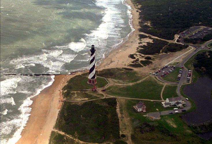
FILE - The Cape Hatteras lighthouse stands, Aug. 29, 1995 on the Outer Banks of North Carolina. (AP Photo/Ruth Fremson, File)
RAF
FILE - A bulldozer clears sand from N.C. highway 12, Sunday, Sept. 21, 2003, in Kill Devil Hills, N.C., after Hurricane Isabel hit North Carolina's Outer Banks. (AP Photo/Bob Jordan)
CMP BJ
People fish along the shore in Arecibo, Puerto Rico, as Hurricane Erin brings rains to the island, Sunday, Aug. 17, 2025. (AP Photo/Alejandro Granadillo)
RE
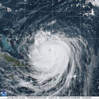
This image provided by the National Oceanic and Atmospheric Administration (NOAA) shows Hurricane Erin on Monday, Aug. 18, 2025. (NOAA via AP)
In this aerial image taken from video provided by WVEC-TV, homes along the Atlantic Coast in Dare County, N.C., are seen, Monday, Aug. 18, 2025, ahead of expected impacts from Hurricane Erin. (WVEC-TV via AP)
In this image taken from video provided by WVEC-TV, a sign warning against beach access is posted in Dare County, N.C., Monday, Aug. 18, 2025, ahead of expected impacts from Hurricane Erin. (WVEC-TV via AP)
In this image taken from video provided by WVEC-TV, a vehicle with a trailer is traveling on Highway 12 in Dare County, N.C., Monday, Aug. 18, 2025, ahead of expected impacts from Hurricane Erin. (WVEC-TV via AP)
Holly Andrzejewski hadn't yet welcomed her and her family's first guests to the Atlantic Inn on Hatteras Island when she had to start rescheduling them, as Hurricane Erin neared North Carolina’s Outer Banks on Tuesday and threatened to whip up wild waves and tropical force winds.
Although the monster storm is expected to stay offshore, evacuations were ordered on such along the Carolina coast as Hatteras as authorities warned the storm could churn up dangerous rip currents and swamp roads with waves of 15 feet (4.6 meters).
Andrzejewski and her husband purchased the bed-and-breakfast, known as the oldest inn on the island, less than a week ago. By Monday they had brought in all the outdoor furniture and made sure their daughter and her boyfriend, who are the innkeepers, had generators, extra water and flashlights as they stayed behind to keep an eye on the property.
“It's just one of those things where you know this is always a possibility and it could happen, and you just make the best out of it. Otherwise you wouldn’t live at the beach,” said Andrzejewski, who will also remain on the island, at her home about a 15 minutes' drive away.
Erin lashed part of the Caribbean with rain and wind Monday. Forecasters are confident it will curl north and away from the eastern U.S., but tropical storm and surge watches were issued for much of the Outer Banks.
Officials at the Wrightsville Beach, near Wilmington, North Carolina, reported to the National Weather Service rescuing at least 60 swimmers from rip currents Monday.
By early Tuesday, Erin had lost some strength from previous days and had maximum sustained winds of 120 mph (195 kph), the National Hurricane Center in Miami said. It was about 685 miles (1,105 kilometers) southwest of Bermuda and 770 miles (1,240 kilometers) south-southeast of Cape Hatteras and was moving northwest at a slower 7 mph (11 kph).
A tropical storm warning remained in effect for the Turks and Caicos Islands, where government services were suspended, some ports were closed and residents were ordered to stay home.
On North Carolina’s Outer Banks, coastal flooding was expected to begin Tuesday and continue through Thursday.
The evacuations on Hatteras Island and Ocracoke came at the height of tourist season on the thin stretch of low-lying barrier islands that jut into the Atlantic Ocean and are increasingly vulnerable to storm surges.
A year ago, stayed hundreds of miles offshore yet still produced high surf and swells that caused coastal damage.
This time there are concerns that several days of heavy surf, high winds and waves could wash out parts of the main highway. Some routes could be impassible for days.
This is the first evacuation for Ocracoke since in 2019 caused the most damage in the island's recorded history.
Tommy Hutcherson, who owns the community’s only grocery store, said the island has mostly bounced back. He’s optimistic this storm won’t be as destructive.
“But you just never know. I felt the same way about Dorian and we really got smacked,” he said.
Scientists have linked the in the Atlantic to climate change. Global warming is causing the and is spiking ocean temperatures, and warmer waters give hurricanes fuel to unleash more rain and strengthen more quickly.
Bermuda will experience the most severe threat Thursday evening, said Phil Rogers, director of the Bermuda Weather Service. By then, waters could swell up to 24 feet (7 meters).
“Surfers, swimmers and boaters must resist the temptation to go out. The waters will be very dangerous and lives will be placed at risk,” acting Minister of National Security Jache Adams said.
___
Associated Press journalists Safiyah Riddle in Montgomery, Alabama, and Julie Walker in New York contributed to this report.