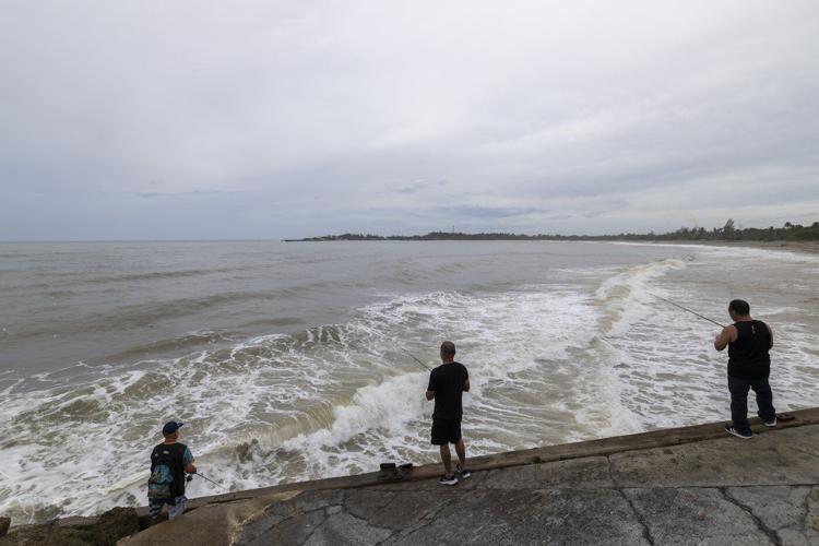
People fish along the shore in Arecibo, Puerto Rico, as Hurricane Erin brings rains to the island, Sunday, Aug. 17, 2025. (AP Photo/Alejandro Granadillo)
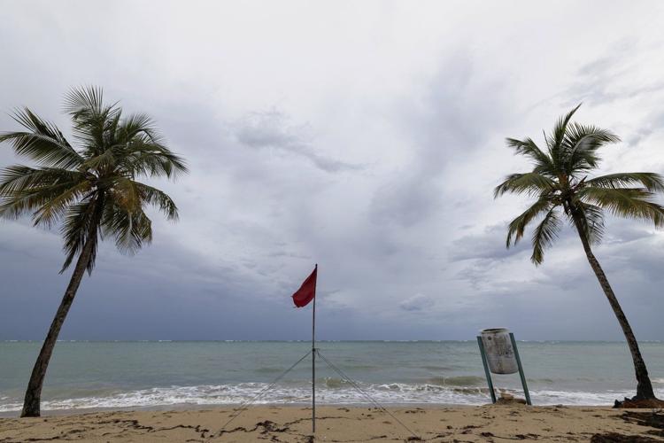
A red flag warns of dangerous waves on an empty beach in San Juan, Puerto Rico, after Hurricane Erin passed by near the island on Sunday, Aug. 17, 2025. (AP Photo/Alejandro Granadillo)
People fish along the shore in Arecibo, Puerto Rico, as Hurricane Erin brings rains to the island, Sunday, Aug. 17, 2025. (AP Photo/Alejandro Granadillo)
RE
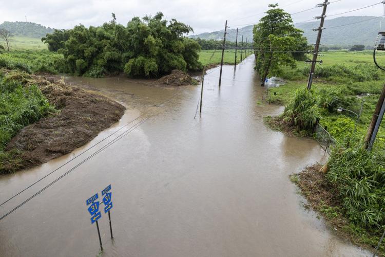
Water floods a road in Naguabo, Puerto Rico, as Hurricane Erin brings rain to the island, Sunday, Aug. 17, 2025. (AP Photo/Alejandro Granadillo)
RE
A red flag warns of dangerous waves on an empty beach in San Juan, Puerto Rico, after Hurricane Erin passed by near the island on Sunday, Aug. 17, 2025. (AP Photo/Alejandro Granadillo)
RE
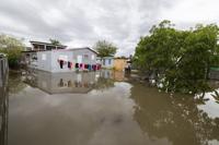
Water surrounds a house in Guayama, Puerto Rico, as Hurricane Erin brings rains to the island, Sunday, Aug. 17, 2025. (AP Photo/Alejandro Granadillo)
RE
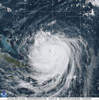
This image provided by the National Oceanic and Atmospheric Administration (NOAA) shows Hurricane Erin on Monday, Aug. 18, 2025. (NOAA via AP)
MIAMI (AP) ŌĆö Hurricane Erin strengthened again Monday as it began pelting part of the Caribbean with rain and wind before it's expected to create dangerous surf and rip currents along the U.S. East Coast this week.
The monster storm intensified to a Category 4 with 130 mph (215 kph) maximum sustained winds early Monday while it started to lash the Turks and Caicos Islands and the southeast Bahamas, according to the U.S. National Hurricane Center in Miami.
Forecasters are confident that Erin will turn northeast and away from the eastern U.S., but it's still expected to churn up dangerous waves and rip currents and could bring tropical force winds to North Carolina's Outer Banks, said Dave Roberts of the National Hurricane Center.
Evacuations were beginning Monday on Hatteras Island on the Outer Banks, the thin stretch of low-lying barrier islands that juts far into the Atlantic.
There are concerns that several days of heavy surf, high winds and waves could wash out parts of the main highway running along the barrier islands, the National Weather Service said.
But there were no signs of panic on Hatteras Island, said Angela Tawes, a co-owner of ConnerŌĆÖs Supermarket. ŌĆ£ItŌĆÖs so beautiful outside. ItŌĆÖs hard for people to feel like thereŌĆÖs a hurricane coming when itŌĆÖs so gorgeous,ŌĆØ she said.
Erin, the yearŌĆÖs first Atlantic hurricane, reached a dangerous Category 5 status Saturday with 160 mph (260 kph) winds before weakening. While Erin is expected to remain a large, major hurricane into midweek and impact coastal areas, it isnŌĆÖt forecast to make direct landfall.
ŌĆ£YouŌĆÖre dealing with a major hurricane. The intensity is fluctuating. ItŌĆÖs a dangerous hurricane in any event,ŌĆØ the hurricane center's Richard Pasch said.
Early Monday, the storm was located about 115 miles (190 kilometers) north-northeast of Grand Turk Island and about 890 miles (1,430 kilometers) south-southeast of Cape Hatteras, North Carolina. It was moving northwest at 13 mph (20 kph).
The Bahamas government issued a tropical storm watch for the central Bahamas, while a warning remained in effect for the Turks and Caicos Islands and southeast Bahamas, the hurricane center said.
ErinŌĆÖs outer bands pelted parts of Puerto Rico and the Virgin Islands with heavy rains and tropical-storm winds on Sunday.
Scientists have linked the in the Atlantic to climate change. Global warming is causing the and is spiking ocean temperatures, and warmer waters give hurricanes fuel to unleash more rain and strengthen more quickly.